
Ship monitoring
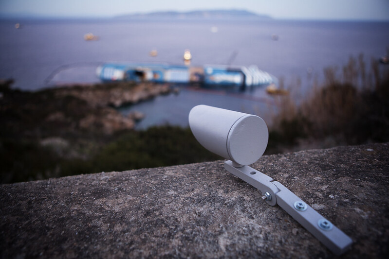
To ensure safety during search and rescue operations, debunkering, and material recovery from the ship, it is essential to monitor the ship’s position and movements in real time.
To provide effective monitoring, including an early warning function, the Civil Protection Department engages Competence Centers and research institutes.
The system consists of independent monitoring techniques and networks that enable the differentiated measurement of the hull’s movements, thereby enhancing the accuracy and reliability of the data. The data are continuously shared with the Technical-Scientific Committee.
DST UniFI - Department of Earth Sciences, University of Florence. The Department sets up a three-dimensional, long-range laser scanning system to collect data used to create a digital model of the ship. By comparing successive digital models, it is possible to map the ship’s movements over time. The Department is also responsible for coordinating scientific activities and integrating the data collected from the various ship-monitoring systems.
Geohazard Monitoring Group. The Group installs a fully automated Leica TM30 Robotic Total Station capable of remotely acquiring high-resolution data. Every 15 minutes, the total station performs a measurement cycle on 12 prisms installed in key areas of the ship in collaboration with the SAF (Speleo Alpino Fluviale) group of the Italian National Fire and Rescue Service. The data collected from the 12 prisms enable the accurate determination of three-dimensional displacements of the above-water section of the ship, with millimeter-level precision, while also allowing the assessment of relative movements and displacement components associated with external factors. The use of instrumental and computational techniques helps minimize the effects of atmospheric conditions, such as wind, rain, and variations in humidity, which are particularly significant in an operational context of this kind.
ASI - Italian Space Agency. It provides very high-resolution Spotlight satellite radar images acquired by the CosmoSky-Med system and processed by Telerilevamento Europa and the Polytechnic University of Milan. These images help assess the ship’s movements and map any fuel spills during recovery operations.
OGS - National Institute of Oceanography and Applied Geophysics. It uses a technique based on the transmission of high-frequency acoustic pulses that reflect off the seafloor to reconstruct a detailed three-dimensional model of its topography. This system makes it possible to assess the structure and stability of the seafloor supporting the ship and, more generally, to produce a detailed bathymetric map of the seabed.
JRC - Joint Research Centre of the European Commission. It installs a ground-based radar system using MIMO-SAR interferometric technology for continuous, real-time monitoring of ground deformation through the acquisition and processing of radar images. The system is capable of operating regardless of visibility or weather conditions.
Prato Ricerche Foundation. It installs a microseismic monitoring network. The monitoring system is complemented by a GPS station installed in the early hours of the emergency by the Technical Rescue Service, as well as an accelerometer system installed by a company contracted by the shipowner.
Support for marine weather forecasting and oceanographic modeling is provided by GNOO - the National Group for Operational Oceanography of INGV in Bologna; the LaMMA Consortium - Environmental Monitoring and Modeling Laboratory for Sustainable Development; ISPRA - the National Institute for Environmental Protection and Research; and the Functional Centre of the Region of Tuscany.